
Course Information
The course is loops of 6.70 miles that runs along a stretch of the Saxon Shore Way between Margate and Westgate around The Bay, Westbrook Bay and St Mildreds Bay.
You can view the route on MapMyRun here
The total elevation gain is probably sub 100' for each loop. Navigation is simple, always hold on the path nearest the sea, at the Westgate end you simply turn around at the end of the sea wall, at the Margate end you turn around at the Shell Lady Statue on the end of Margate Pier.

Turn around at the Westgate end of the course
You'll pass along Margate sea front, which in Winter is fairly depressing but this is probably the highlight of the route that is otherwise dominated by the concrete sea wall that stretches around the base of the low cliffs on this part of the coast, on a clear day you can see an awful lot of quite dull sea, on a dull day, you'll see some murky sea. There is a wind farm to look at, and there is always a bit that seems to have some sea weed on it, the car park though is on the route so you can use the car as a drop bag, maybe have something there you can look forwards to. If you've ever done the Kent Coastal Marathon then you'll know what I mean. If you haven't, then this is the best coastal marathon in the land!
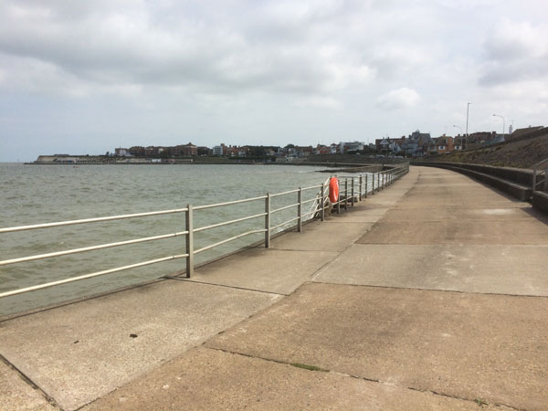
Typical view, it's wide, its flat, its grey. This is not in fact a black and white image.
For those who have done this route before you'll notice that we've taken out the hill! The forecast is good so think we can live without the shelter on top of the cliffs.

The sea wall is the right, just go around the barrier (Rachel is cunningly obscuring the big gap to go through) - And across the bridge and carry along. This is not the turnaround!

Run along the pier, touch the skirt of Mrs Booth the Shell Lady and head back the way you came.